-
 01.
01.With fast data acquisition ability, a single image to obtain millions or even tens of millions of points of topography data. Scan table 360° rotation, no dead corners to obtain full circle real 3D data. Greatly improve work efficiency.
-
02.
With extremely high accuracy, laser scanner can accurately capture the fine features and contour changes of the surface of the object. The linearity can reach ±0.02%. The advantage is more obvious when the measurement of high-low difference objects and the location of the measurement objects change.
-
03.
The non-contact measurement method avoids the damage to the measured object, scanning sensor ensures the integrity of the object, and has a strong adaptability, can work stably in a variety of complex environments.
-
04.
Laser profiler sensor meets the IP67 standard, even in a humid and dusty environment, but also safe to use.
-
05.
Handheld lidar scanner can accurately measure black objects with low reflectivity and metal objects with high reflectivity at the sametime.
-
06.
Laser profile sensor's brightness can be automatically optimized without the help of external light sources.
-
07.
The use of high toughness cable, which can withstand up to 30 million bends, equipped with the machine.
-
 1
1 -
 2
2 -
 3
3 -
 4
4 -
 5
5 -
 6
6
-
01.
Weld shape detection
Three-dimensional laser profile scanning can accurately detect the shape, width, depth and other parameters of the weld, determine whether the weld is uniform and continuous, and whether there are porosity, slag inclusion, incomplete penetration and other defects, so as to evaluate the quality of the weld.
-
02.
Stamping parts inspection
Use 3D laser profile scanning sensor to detect the size, shape, width, height, etc., to determine whether there are burrs, wrinkles, cracks, surface scratches, bumps, etc.
-
03.
Product packaging inspection
Three-dimensional laser contour scanning is used to detect the outer packaging of boxed products to determine whether the outer packaging is damaged, deformed, poorly sealed, whether there is any stain, whether it is damp, whether the mark is correct and so on.
-
04.
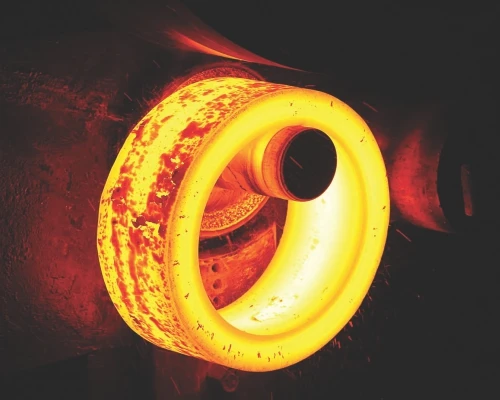
The application of handheld scanners on castings.
Handheld laser scanners play an important role in the casting industry.
Firstly, in terms of quality inspection, it can quickly and accurately obtain three-dimensional data of castings. By comparing with the original design model, it can accurately detect defects, deformations, dimensional deviations, and other issues on the surface of castings. Moreover, the scanner can comprehensively scan the used molds, analyze their wear and tear, and provide accurate data support for subsequent repairs and optimizations. In reverse engineering, handheld laser scanners can scan old castings to obtain accurate 3D models, providing design references for the development of new products.
-
05.
Robot arm guidance
3D laser profile scanning can provide high-precision object surface profile information to help the robot arm accurately determine the position and posture of the object to grasp, operate or process. For example, in an assembly job, a robot arm can accurately grab and place a part based on scanned data about its shape and position. By scanning the working environment and the target object, the robot arm can obtain detailed spatial information to optimize the motion path. This helps avoid collisions, reduce exercise time, and increase productivity.
-
06.
Tire inspection
The 3D laser profile scanning sensor can find defects such as cracks, bubbles, uneven wear and foreign body embedding on the tire surface, and accurately measure key dimensions such as the tire's outer diameter, inner diameter, tread width, side thickness, and pattern depth to ensure that the tire meets the design specifications and quality standards.
-
Unlocking Potential: What Is 3D Scanning Used For?
-
3D scanning is a transformative technology used to capture the precise shape and dimensions of objects, creating detailed digital models that replicate their physical characteristics. By employing lasers, structured light, or photogrammetry, 3D scanners collect data on an object’s surface and geometry, making it an invaluable tool across diverse industries.
In manufacturing, 3D scanning is widely used for quality control and reverse engineering. It ensures that products meet exact specifications by comparing scanned models to original CAD designs. For reverse engineering, 3D scanning helps recreate obsolete or custom components, enabling manufacturers to produce replacements or improve existing designs.
In healthcare, 3D scanning is revolutionizing prosthetics and medical device development. By creating custom-fitted prosthetics and orthotics tailored to a patient’s unique anatomy, 3D scanning improves comfort and functionality. It is also employed in surgical planning, where accurate 3D models of bones and organs guide complex procedures.
The entertainment and gaming industries utilize 3D scanning to create realistic digital assets. It captures intricate details of physical objects or actors, reducing time and effort in creating lifelike animations for movies, games, and virtual reality applications.
In architecture and construction, 3D scanning aids in capturing as-built conditions for renovations or documentation of historical sites. Scanned data ensures accuracy in design planning and allows architects to work with precise representations of existing structures.
-
Understanding the Principle Behind Laser Triangulation Sensors
-
Laser triangulation sensors are precision measurement tools widely used for non-contact distance and profile measurements. Their operating principle is based on the geometry of triangulation, where a laser beam is projected onto a target surface, and the reflected light is captured by a detector, typically a CMOS or CCD sensor. The sensor's position relative to the laser source and the measured surface determines the distance or displacement through angular calculations.
The process begins with the laser emitting a focused beam onto the object. As the light reflects off the surface, its angle changes depending on the distance between the sensor and the object. A lens directs the reflected light onto the detector, where the position of the laser spot on the detector shifts in response to the reflection angle. This positional change is directly correlated to the distance of the target, allowing the sensor to calculate the precise measurement.
One of the key advantages of laser triangulation sensors is their ability to measure with high accuracy and speed, making them ideal for dynamic applications like industrial automation, robotics, and quality control. They perform well on a variety of surfaces, from smooth to textured, and can capture measurements even in challenging conditions, such as vibrations or rapid movements.
Q1:Are you trading company or manufacturer?
We are manufacturer.
Q2: Can we be your distributor?
We are looking for distributor and agent all over the world.
Q3: How's the package?
Normally are cartons, but also we can pack it according to your requirements.
Q4: How's the delivery time?
lt depends on the quantity you need, 1-25 days usually
Q5:What is LiDAR Scanning?
LiDAR (Light Detection and Ranging) scanning is a remote sensing method that uses light in the form of a pulsed laser to measure variable distances to the Earth. These light pulses—combined with other data recorded by the airborne, terrestrial, or mobile system—generate precise, three-dimensional information about the shape of the Earth and its surface characteristics.
Q6:How does LiDAR technology work?
LiDAR works by emitting laser pulses from an aircraft or drone and measuring the time it takes for the light to return. The time taken for the light to bounce back is used to calculate distances. By repeating this process many times, a detailed 3D map of the surface can be created.
Q7:What are the primary applications of LiDAR scanning?
LiDAR scanning is used in a variety of fields including archaeology, geography, geology, seismology, forestry, and many others. It is particularly useful for creating high-resolution maps, studying terrain, forest canopy, and urban environments, as well as for navigation and obstacle avoidance in autonomous vehicles.
Q8:What are the advantages of LiDAR over traditional surveying methods?
LiDAR offers several advantages over traditional surveying methods, including faster data acquisition, higher accuracy, and the ability to penetrate vegetation and other ground cover to reveal the terrain beneath. It also allows for the collection of data in areas that are difficult to access physically.
Q9:Is LiDAR technology expensive?
LiDAR technology can be expensive, especially for high-end systems used in professional applications. However, costs have been decreasing, and there are now more affordable options available for smaller projects or research purposes.
Q10:Can LiDAR be used for indoor mapping?
Yes, LiDAR can be used for indoor mapping, although it is more commonly associated with outdoor applications. Indoor LiDAR systems are used for creating detailed floor plans, navigation in autonomous robots, and for various other applications in architecture, construction, and facility management.
Q11:What are the limitations of LiDAR scanning?
Some limitations of LiDAR scanning include its sensitivity to weather conditions, such as heavy rain or fog, which can interfere with the laser pulses. Additionally, while LiDAR can penetrate vegetation to some extent, dense foliage can still obstruct the laser and limit the accuracy of the data collected on the ground.
Q12:How is LiDAR data processed?
LiDAR data processing involves several steps, including filtering out noise and irrelevant data, classifying points into categories (such as ground, vegetation, buildings), and creating digital elevation models (DEMs) or other derived products. Sophisticated software tools are used to manage and analyze the large datasets generated by LiDAR systems.
Q13:Can LiDAR scanning be used for real-time applications?
While LiDAR data collection itself can be rapid, the processing and analysis of the data typically require significant computational resources and time. However, advancements in technology are enabling more real-time applications, such as in autonomous vehicles where LiDAR is used for immediate obstacle detection and avoidance.
Q14:What is the future of LiDAR technology?
The future of LiDAR technology looks promising, with ongoing research and development focused on miniaturization, cost reduction, and improved accuracy. We can expect to see LiDAR playing an increasingly important role in autonomous driving, urban planning, and environmental monitoring, among other areas.
Q16: How safe is Lidar Scanning for human use?
A: Lidar scanning is generally considered safe for human use. The laser light emitted by Lidar systems is typically within the safe exposure limits set by regulatory bodies, such as the International Electrotechnical Commission (IEC) or the U.S. Food and Drug Administration (FDA). However, it is always advisable to follow safety guidelines and wear appropriate protective equipment when working with Lidar systems.
Q17: Can Lidar Scanning be used in areas with heavy vegetation?
A: Yes, Lidar scanning can be used in areas with heavy vegetation, although it may require specialized techniques and adjustments to the system's settings. The laser light emitted by Lidar systems can penetrate through leaves and branches to capture underlying features, such as tree trunks and the ground surface. However, dense vegetation can still affect the quality and accuracy of the data collected.
Q18: How do I ensure the accuracy of Lidar Scanning data?
A: Ensuring the accuracy of Lidar Scanning data involves several steps, including proper system calibration, precise positioning of the scanner, and careful processing of the data. It is also important to consider factors such as weather conditions, reflective surfaces, and obstructions that can affect the quality of the data. To further improve accuracy, users may need to employ ground control points or other survey methods to validate the data.
Q19: Is Lidar Scanning suitable for scanning moving objects?
A: Lidar scanning can be challenging when scanning moving objects, as the movement can introduce errors and distortions in the data. However, there are specialized techniques and systems available that are designed to capture dynamic scenes, such as those involving moving vehicles or pedestrians. These systems typically use faster scanning rates and more sophisticated data processing algorithms to account for the movement.
Q20: How do I choose the right Lidar Scanning system for my needs?
A: Choosing the right Lidar Scanning system depends on several factors, including the specific application, the required accuracy and resolution, the size and complexity of the area to be scanned, and the budget. It is important to research different systems and their capabilities, as well as consider the level of support and training available from the manufacturer. Additionally, users may want to consider the portability and ease of use of the system, as well as its compatibility with other software and hardware tools.
Q21: How do I protect my Lidar Scanning data from unauthorized access?
A: Protecting Lidar Scanning data from unauthorized access involves implementing appropriate security measures, such as encryption, password protection, and access control. It is also important to store data securely and back it up regularly to prevent loss or corruption. Users should also be aware of potential cybersecurity threats and take steps to mitigate them, such as keeping software and hardware updated and avoiding the use of unsecure networks.