Dec . 03, 2024 17:31 Back to list
laser scanning and surveying
Laser Scanning and Surveying Revolutionizing Measurement Techniques
In recent years, the fields of surveying and measurement have undergone a significant transformation, driven largely by advancements in technology. Among these innovations, laser scanning has emerged as a game-changer, offering unparalleled accuracy, efficiency, and versatility in capturing spatial data. This article explores the principles of laser scanning, its applications, advantages, and challenges, highlighting why it is becoming an essential tool in various industries.
Understanding Laser Scanning
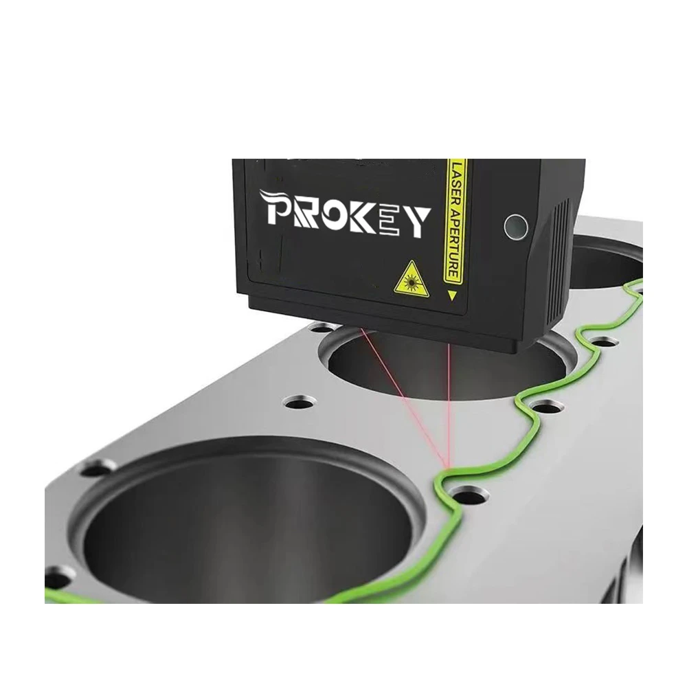
Laser scanning, also known as light detection and ranging (LiDAR), involves using laser beams to measure distances between the scanner and a target object. A laser scanner emits thousands of laser pulses per second, which bounce back from surfaces and are recorded by the device. By calculating the time it takes for the laser to return, the system can create a precise and detailed 3D representation of the scanned environment, known as a point cloud.
The technology can be static or mobile. Static laser scanners are usually fixed in place to capture detailed images of structures, while mobile scanners can be mounted on vehicles or equipment, allowing for the rapid collection of data over larger areas. This versatility makes laser scanning suitable for a wide range of applications, from construction and architecture to environmental monitoring and disaster management.
Applications of Laser Scanning
One of the most significant benefits of laser scanning is its wide range of applications across various industries
1. Architecture and Construction In architectural design and construction, laser scanning is instrumental in creating accurate as-built drawings of existing structures. It helps architects and engineers visualize projects, identify potential issues, and communicate effectively with stakeholders, ensuring that projects stay on schedule and within budget.
2. Cultural Heritage Preservation Laser scanning has become a vital tool for documenting historical sites and artifacts. It allows conservators to create detailed 3D models of cultural heritage structures, enabling them to study and preserve these sites for future generations without causing any damage.
3. Topographic Surveys In civil engineering and land surveying, laser scanning provides precise topographical data that is critical for site analysis, land use planning, and environmental assessment. This information aids in the design of infrastructure such as roads, bridges, and utilities.
laser scanning and surveying
4. Mining and Quarrying The mining industry increasingly relies on laser scanning for volumetric analysis and site monitoring. By capturing real-time data on stockpiles and excavation sites, operators can optimize resource extraction and improve safety measures.
5. Forestry and Environmental Studies Laser scanning enables ecologists and environmental scientists to analyze forest structure, biomass, and biodiversity. It allows them to create detailed 3D models of vegetation, helping in habitat assessment and conservation efforts.
Advantages of Laser Scanning
The advantages of laser scanning are manifold
- High Precision Laser scanning provides millimeter-level accuracy, making it suitable for projects where detail is crucial. - Speed The ability to quickly collect large amounts of data saves time compared to traditional surveying methods, significantly accelerating project timelines. - Comprehensive Data Capture The 3D point cloud generated contains rich information that can be used for a variety of analyses, facilitating better decision-making. - Safety Laser scanning reduces the need for personnel to enter hazardous environments, improving workplace safety.
Challenges and Considerations
Despite its numerous advantages, laser scanning does come with challenges. The equipment can be expensive, and the technology demands skilled operators who can interpret the data properly. Additionally, large datasets require substantial storage and processing capabilities, which can pose logistical issues for some organizations.
Conclusion
Laser scanning has undoubtedly revolutionized the way surveying is conducted across various industries. Its ability to capture accurate and detailed spatial data swiftly and safely has made it an indispensable tool in modern measurement practices. As technology continues to evolve, we can expect to see even more innovative applications of laser scanning, paving the way for advancements in engineering, architecture, environmental conservation, and beyond. As we embrace these new methodologies, the potential for more informed decision-making and enhanced project outcomes is greater than ever.
-
Why Steel Mills Rely on FODA’s High-Temperature Cylindrical Roller Bearings?
NewsApr.10,2025
-
What is a Plain Bearing? A Complete Guide to Design & Functionality
NewsApr.10,2025
-
Thrust Ball Bearings vs. Tapered Roller Bearings: FODA’s Performance Comparison
NewsApr.10,2025
-
The Engineering Behind FODA Thrust Ball Bearings: Precision for High-Speed Applications
NewsApr.10,2025
-
No More Compromises: Get Precision-Engineered Custom Bearings Tailored to Your Exact Specifications
NewsApr.10,2025
-
In-Depth Analysis: Application Differences of Different Types of Angular Contact Ball Bearings
NewsApr.10,2025
Products categories


